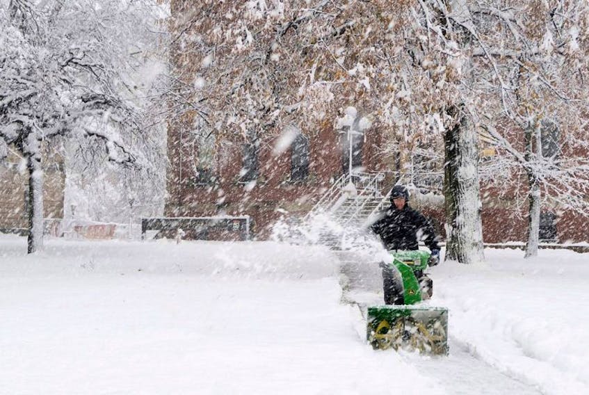
It looks like the March lion is arriving in P.E.I. a few days late this year.
While the first week of March saw mild weather, along with little precipitation, which has beeen something of a trend in the province this winter, it appears Islanders may need to get their snow shovels back out.
Environment Canada has issued a special weather statement for all of P.E.I. for snowfall expected on Thursday, Friday and Saturday.
“I guess you could describe this as March coming in like a lion,” said Environment Canada meteorologist Stephen Hatt. “Let’s hope it goes out like a lamb.”
Snowfall is expected to begin today by noon.
About five to 10 cm of wet snow, heavy at times, is forecast to fall as the low system tracks west of Nova Scotia.
Snowfall will then taper off to either flurries or showers this evening as the low stalls over Maine.
However, as that first low stalls, a second weather system will be moving up from the south towards Cape Breton.
It is expected to bring a heavier snowfall of up to 15 cm to P.E.I. late Friday afternoon and overnight into Saturday.
“This is a very complex weather situation,” said Hatt. “(The second low) looks like it’s going to have a higher amount of snowfall for P.E.I. Friday night and into Saturday.”
Hatt said freezing rain will likely not be an issue with either of the weather systems.
While it’s unlikely to hit P.E.I., Environment Canada is also keeping an eye on a third low that could affect the province early next week.
Hatt said the system will likely be too far east to give any precipitation on P.E.I.
“But there is some possibility that it could shift to the west, so we can’t rule out another system coming early next week,” he said. “At this point, I’d say it’s not likely, but it definitely is a possibility.”
[email protected]
Twitter.com/Mitch_PEI