The Island weathered the Christmas Day storm and is preparing for a cold snap.
The storm that hit the Island on Christmas Day brought blowing snow, freezing rain, high winds and reduced visibility.
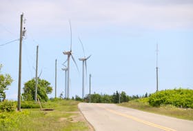
The highest winds were recorded in St. Peter’s, with gusts reaching up to 96 km/h.
North Cape winds rose to 89 km/h, where winds in Charlottetown and Summerside hit 75 and 82 km/h, respectively. Winds in East Point got up to 87 km/h.
Charlottetown saw mixed precipitation, including three hours of freezing rain.
Central areas saw around 5 cm of snow, where Wellington saw 8 cm. There wasn’t a recorded amount for the extreme northwest parts of the Island, but that area had the worst impacts with snow and blowing snow through Christmas Day.
While snow isn’t in the immediate forecast, colder temperatures are.
Environment Canada meteorologist Mel Lemmon said the temperatures will drop over the next day or two and then remain cold for some time.
Gusty winds and temperatures around -5 C will fall tonight overnight, but with the wind chill, it will feel more like -25 C Wednesday night into Thursday morning could be even cooler, Lemmon said.
“The winds are going to stay strong and the temperatures may fall even slightly further,” he said, adding with wind chill it will be cooler than -25 C.
The weather this time of year varies, so the Christmas Day storm was not unusual.
“That’s fairly typical to have something around this time of year,” he said, adding the cold temperatures aren’t necessarily typical.
“This certainly is a cold snap and below seasonal values for sure in terms of temperatures.”
With the cold weather expected for the next few days, Lemmon said it might start to warm up a little bit heading into the weekend.
“There’s a slight chance that there could be another storm coming, but we’re not sure exactly what track that’s going to take yet. Right now it looks like it’s going to just bring us snow, not a mixed precipitation event like we just had,” he said, adding it won’t be as windy. “It’s possible we may get nothing from it.”