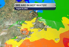
Last weekend’s storm came through with 40 mm of rain, more than 30 cm of snow and wind gusts well over 100 km/h.
It was a powerful spring storm with a rapid drop in pressure - enough to be considered a weather bomb. I’ve been asked by some to stop using the term, but it is an official meteorological event that occurs when a strengthening weather system displays rapid cyclogenesis or intensification. If the pressure drop is equal to, or greater than, 24 millibars in 24 hours or less, the storm can be labelled a weather bomb.
That kind of strengthening is often the result of two very different air masses in close proximity. On Friday, the Bermuda High was pulling warm, moist air into the developing system coming out of Texas. Meanwhile, cold dry air was funnelling down into the top of the area of low pressure.
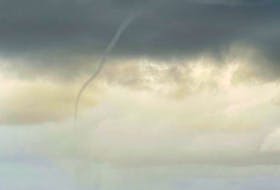
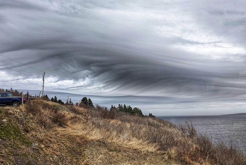
Saturday evening, the storm system sat over Miramichi, New Brunswick. Hundreds of kilometres away, in Petty-Harbour-Maddox Cove, N.L., instability was growing. And that’s when Kristi Allan spotted these asperitas clouds.
Asperitas is a distinctive, but relatively rare, cloud formation that often looks like waves on the ocean. These undulating structures form on the underside of the cloud to make it look like a rough sea surface when viewed from below.
How asperitas clouds form is somewhat a mystery. There is speculation that the wave formation occurs when cold air descends into an area of the sky where the wind direction changes with height, resulting in the wave-like movement. What is clear, however, is atmospheric conditions must be unstable and it sure was last weekend.
At the World Meteorological Organization’s 17th Congress in 2015, the suggested cloud was accepted, making asperitas the first new cloud type in more than 50 years.
There have been a few sightings over Atlantic Canada, but these clouds remain quite rare and are often a sign of things to come. Not long after the waves appeared in the sky, there were crashing waves below as a powerful spring storm rolled through.
- Want more weather information? Visit your weather page.
- Have a weather question, photo or drawing to share with Cindy Day? Email [email protected]
Cindy Day is the chief meteorologist for SaltWire Network