I love the science of meteorology. I remember years ago when I worked at CFRA radio in Ottawa, the late Hal Anthony took me aside and said: “If you hope to have a long career in this, you have to find a way to make us understand what you know and make it interesting.” It turns out, that advice was golden.
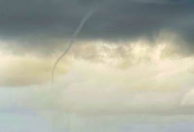
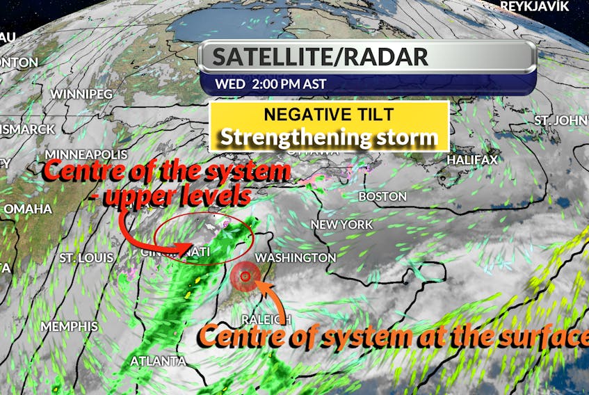
Now and again, during a weather presentation, I get caught up in the moment and I use a word or an expression that needs some explanation. Last week, while describing the potentially powerful storm that was headed for Ontario and Quebec, I mentioned that the developing trough had a “negative tilt.” Not long after I posted the video, someone asked about it. I quickly realized I should have explained it.
Let’s start with the trough. A trough is an extension from an area of low pressure. Troughs can be tilted in one of three ways: positive tilt, neutral tilt, and negative tilt. In our hemisphere, a positively tilted trough tilts from the northeast toward the southwest, a neutrally tilted trough stretches from north to south, and a negatively tilted trough tilts from northwest toward southeast. The atmosphere becomes very unstable when a large trough, associated with a strong developing storm, becomes negatively tilted. When this happens, the right side of the trough causes cold air advection in the upper levels of the atmosphere. Meanwhile, the lowest level of the atmosphere that comes into contact with the surface of the earth (the planetary boundary layer or PBL) is warm and humid. Cold air above warm air creates thermodynamic instability and convective instability.
The science of the atmosphere is complex and while we experience our weather close to the ground, it all starts high above the surface of the earth.
Thank you for paying attention, for wanting to learn and for being curious enough to ask questions!
- Want more weather information? Visit your weather page.
- Have a weather question, photo or drawing to share with Cindy Day? Email [email protected]
Cindy Day is the chief meteorologist for SaltWire Network