It's been a strange winter. Average temperatures for January were three or more degrees above normal - record-setting in some places - and we received only about half the usual amount of snow for the month.
February is off to a very mild start: white or wet – depending on where you woke up this morning, but that’s going to change next week.
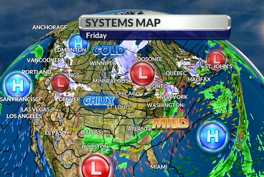
Ahead of the bone-chilling cold snap, several fast-moving weather makers will cross Atlantic Canada. The first in that series will race offshore tonight with wet snow that will change to rain ahead of a mild, pleasant Saturday afternoon. The next system should track south of Sable Island Sunday night, cooling things down for Monday.

The one after that should be interesting; rolling into western regions on Monday, with snow that will change to rain as the low tracks towards the west coast of Newfoundland by Wednesday morning. That system could dump 15 cm of snow across the region before the changeover to rain.
A wind-shift to the north behind the messy system will cool things down and turn up the windchill factor. By Wednesday, feel-like temperatures will range from -10 to -20 during the day!
This cold spell is expected to linger: that will come as good news for ski hill operators and backyard rink builders alike.

- Want more weather information? Visit your weather page.
- Have a weather question, photo or drawing to share with Cindy Day? Email [email protected]
Cindy Day is the chief meteorologist for SaltWire Network