People have said to me, “How hard can it be to predict the weather, it travels from west to east.”
If only it were that simple.
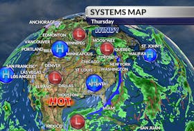
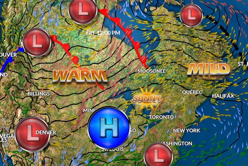
All week, we watched as a powerful fall storm tracked towards – then intensified over – Lake Superior. On Tuesday, that massive system was responsible for flooding along the Red River in Winnipeg, snow in Kenora, Ont., and showers and thundershowers over the Lower Great Lakes; a trough from the storm stretched all the way down to northern Florida.

We can be grateful that not all systems move from west to east – or we might be in our winter boots today. Instead, we stayed on the milder side of that scenario. There is a slight cool-down coming but it will be brief. A north wind rotating clockwise ahead of a fair-weather system west of us will bring our temperatures back to more seasonal values for the weekend. Next week the wind will come around to the southeast ahead of a system tracking up the eastern seaboard, and it will be fairly mild once again… but it’s just a matter of time.
Without getting too far ahead of myself, let me just say that it looks like it will be a mild Halloween.

- Want more weather information? Visit your weather page.
- Have a weather question, photo or drawing to share with Cindy Day? Email [email protected]
Cindy Day is the chief meteorologist for SaltWire Network.