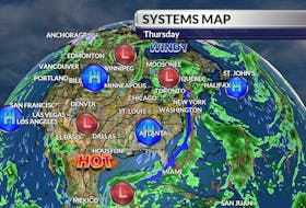
A cold high that has been setting records across parts of western Canada is making its move. The arctic air sat around long enough to become modified, so while it's colder now than it was mid-week, Atlantic Canadians will be spared – at least this time.
Overall, the weekend weather picture will be quiet with some onshore snow along north-facing coastlines. Things could look very different by the end of the day Tuesday!

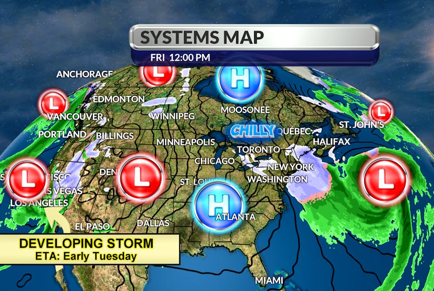
A developing storm that sat off the California coast for days is starting to move inland. The system is thousands of kilometres and 90 hours away; a lot can happen on its way to Atlantic Canada. Right now, it looks like it will track south of the Great Lakes on Saturday, swing off the Carolina Coast Sunday and find its way to Cape Cod on Monday. Western regions should start to see some snow Monday night.
As the system pushes toward our region, the early-week position of a blocking high east of Newfoundland, will determine our precipitation type. Early indications are, it will start as snow, change to rain with an extended period of freezing rain in the east, before going back to snow. Stay tuned.

- Want more weather information? Visit your weather page.
- Have a weather question, photo or drawing to share with Cindy Day? Email [email protected]
Cindy Day is the chief meteorologist for SaltWire Network