The assessment of post-tropical storm Teddy’s impact begins this morning across P.E.I.
Tanya Mullally, the provincial Emergency Measures Organization co-ordinator, and Public Safety Minister Bloyce Thompson held a media briefing on Wednesday afternoon to say that provincial road crews, municipal and community partners are ready to do any restoration work that may be required.
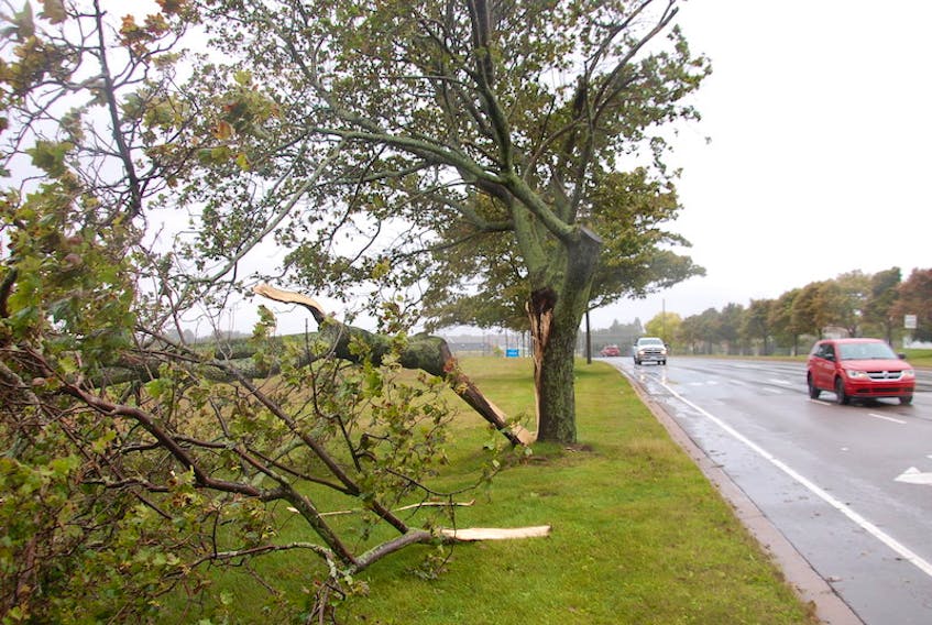
While the initial forecast had strong winds building ahead of the system on Tuesday night, it was relatively calm across the province overnight. Things intensified a bit on Wednesday, at least with the wind.
All schools were closed for the day. Restrictions were in place on Confederation Bridge, while Northumberland Ferries Ltd. tied up its ships.
“We were very prepared for this storm and we’re lucky it’s not as severe as it could have been,’’ Thompson said. “It never hurts to be safe. I can’t emphasize that enough.’’
Mullally said there were no road closures or washouts were reported.
Still, she said it was important to try to limit the number of vehicles on Island roads.
“We wouldn’t want to put people out in the most significant wind speeds this afternoon,’’ Mullally said.
Need to know
The following information was released by the Emergency Measures Organization on Wednesday:
- Road crews will be clearing provincial road of potential debris beginning Thursday morning.
- Islanders who need to use a generator should do so at least five feet away from anything that can catch fire and always allow them to cool before refueling.
- Contact local municipality for reception centre openings and closures.
- Call ahead to confirm any health appointments before travelling.
- Take photos and videos to use when reporting damages to your insurance company.
Kim Griffin, corporate spokeswoman with Maritime Electric, said as of 4 p.m. on Wednesday, the utility had responded to fewer than 100 individual outages since the system began to impact the province on Tuesday.
Griffin added that 60 crews were positioned in the east, west and central portions of the Island to respond to anything that might come up.
"This storm, for us, was really about readiness,'' Griffin said, adding that the utility didn't want to run out of supplies such as chainsaw oil like it did after post-tropical storm Dorian last year.
"Dorian was the most destructive storm I've seen in my time here. This storm didn't hit us as projected, but we have to be ready and I noticed quite a difference in readiness this time People were so impacted by Dorian. We wanted to be more ready.''
Griffin said Maritime Electric had nine meetings with staff in operations prior to hurricane season and conducted a helicopter inspection to determine issues with foliage that might impact power lines.
Part of trying to be more prepared is having crews come in from out of province.
On Thursday, Griffin said prior to the storm they had crews coming in from Ontario but were told to turn around after post-tropical storm Teddy delivered much less of a punch than originally thought.
The Emergency Measures Organization is also being proactive and is in the process of setting up a 1-800 number that Islanders will be able to use in the event of a future bad storm.
Even though Teddy didn’t pack a big punch, Mullally said she wants to remind everyone that there are still six weeks left in the Atlantic hurricane season. And, that’s followed by winter.
Cindy Day, chief meteorologist with the SaltWire Network, also held a media briefing on Wednesday. She said Teddy made landfall between Sheet Harbour and Port Bickerton, N.S., between 8 and 9 a.m. Wednesday, resulting in strong winds and crashing waves on the Atlantic coast of Nova Scotia. Parts of Cape Breton saw 112 millimetres of rain and wind speeds of 110 km/h while the southwest corner of Newfoundland and Labrador felt gusts reaching 130 km/h.
On P.E.I., between 50 and 60 millimetres of rain had fallen by 9 a.m. Wednesday with another 20 millimetres expected.
Day said the wind was expected to be fairly sustained around 50 km/h through the afternoon with gusts reaching a possible 100 km/h. Winds were expected to diminish Wednesday night to between 40 and 50 km/h.
While parts of Cape Breton were expecting to see a storm surge of 40 centimetres above the usual high tide level, Day said she didn’t think it would be an issue for P.E.I.