Top stories in Prince Edward Island

Fires in Kings County, P.E.I., believe caused by cigarette butts
Updated 8 hours ago
|3 min read

P.E.I. marks first cyberbullying day on April 25, 2024
Updated 3 hours ago
|4 min read
In state of the city address, Summerside mayor says community exploring 33-megawatt green hydrogen project
Updated 10 hours ago
|5 min read
UPDATE: MHL PLAYOFFS – Big saves, third-period goals send Miramichi to come-from-behind win over Caps
Updated 8 hours ago
|8 min read
Build and grow a home mushroom farm with P.E.I expert Rene Lestan
Updated 12 hours ago
|5 min read
Local
More
Fires in Kings County, P.E.I., believe caused by cigarette butts
Updated 8 hours ago
|3 min read
Lobster setting day in Northumberland Strait pushed to April 27
Updated 9 hours ago
|1 min read

P.E.I. marks first cyberbullying day on April 25, 2024
Updated 3 hours ago
|4 min read
In state of the city address, Summerside mayor says community exploring 33-megawatt green hydrogen project
Updated 10 hours ago
|5 min read
P.E.I. woman gets jail for break-in offences
Updated 12 hours ago
|3 min read
Opinion
More
LETTER: Earth Day clean ups are just the tip of the iceberg
Updated 7 hours ago
|4 min read

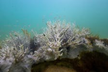
GWYNNE DYER: Arctic seals and coral reefs facing extinction, but every little bit helps
Updated 7 hours ago
|4 min read
LETTER: Justice and science in public health policy needed as federal government hikes taxes for vaping
Updated 8 hours ago
|3 min read
LETTER: Carbon tax is simply another irrational decision by the current government to further burden all of us
Updated 8 hours ago
|8 min read
LETTER: 'Tear down the wall' and let family members inherit fishing enterprises in N.L. without jumping through financial hoops
Updated 10 hours ago
|3 min read
Business
More
Prices at the Pumps: Some small relief, more for diesel
Updated 4 hours ago
|1 min read

Union to launch boycott of Java Blend coffee shops in Halifax
Updated 8 hours ago
|3 min read

CBRM throws its support behind new proposed solar gardens projects
Updated 10 hours ago
|9 min read
Construction boom hits Moncton in first quarter of 2024
Updated 9 hours ago
|2 min read
Bank of Japan may signal near-term rate hike with new price forecasts
Updated 55 minutes ago
|3 min read
Lifestyles
More
DOUG GALLANT: Hornsby, yMusic serve up unique fair
Updated 8 hours ago
|3 min read

UPEI faculty of business receives $3 million donation from Don and Marion McDougall
Updated 11 hours ago
|2 min read

Build and grow a home mushroom farm with P.E.I expert Rene Lestan
Updated 12 hours ago
|5 min read
PAUL SMITH: What's the best bet for raincoats? Plenty of good options for outdoor enthusiasts in N.L.
Updated 12 hours ago
|9 min read
Value for money: Halifax resellers warn of the dark side of vintage shopping
Updated a day ago
|7 min read
Sports
More
TELUS CUP: GM Duane Richards the heartbeat of P.E.I.'s Kensington Wild
Updated a day ago
|7 min read

Pownal falls to Tri-County at Maritime junior C hockey championship
Updated 7 hours ago
|1 min read

P.E.I.'s Kensington Wild plays second one-goal game at Telus Cup
Updated 11 hours ago
|2 min read
P.E.I.'s Kensington Vipers split games at Don Johnson Memorial Cup
Updated 9 hours ago
|2 min read
P.E.I.'s Kensington Vipers win opener at Don Johnson Memorial Cup in dramatic fashion
Updated a day ago
|3 min read
Canada
More
Supreme Court of Canada to hear travel ban appeal
The Supreme Court of Canada announced Thursday, April 25, it has granted leave to hear an appeal connected with a COVID-19 related travel ban put in place in Newfoundland and Labrador during the pandemic.
The Canadian Civil Liberties Association ...
Updated 4 minutes ago
|2 min read
Conservative Leader Poilievre keeps calm, carries on with 'Axe the Tax' tour at Cape Breton stops
Updated 1 hour ago
|7 min read

'It felt like a slap': Cape Breton disability advocate says proposed Canadian disability benefit not enough
Updated 1 hour ago
|6 min read

Four-year jail sentence imposed on Cape Breton man for sex offence
Updated 1 hour ago
|3 min read
HRM mayor responds to homelessness update
Updated 2 hours ago
|3 min read
Savage’s swan song includes advice for next mayor and what’s ahead for Halifax
Updated 3 hours ago
|5 min read
World
More
Healthpeak Properties increases 2024 FFO forecast owing to higher demand
Updated 5 minutes ago
|1 min read

Columbia University faces federal complaint after arresting anti-war protesters
Updated 34 minutes ago
|2 min read

Indigenous people protest Brazil not protecting ancestral lands
Updated 43 minutes ago
|2 min read
North Korea leader Kim Jong Un inspects test-firing of multiple launch rockets, KCNA says
Updated 53 minutes ago
|1 min read
Edwards Lifesciences first-quarter profit beats estimates on heart devices strength
Updated 54 minutes ago
|1 min read
Recent Stories


Colombia arrest warrants suspended for nine Segunda Marquetalia leaders
Updated 4 minutes ago
|1 min read
'Planet of the Apes' franchise looks to the future with new film 'Kingdom'
Updated 15 minutes ago
|2 min read
Columbia University faces federal complaint after arresting anti-war protesters
Updated 34 minutes ago
|2 min read
Indigenous people protest Brazil not protecting ancestral lands
Updated 43 minutes ago
|2 min read