Top stories in Prince Edward Island

P.E.I.'s spring sitting of the legislature has closed. Here are three takeaways
Updated 4 hours ago
|7 min read

P.E.I. lighthouse finalist in Canadian historical place restoration competition
Updated 1 hour ago
|6 min read

More security needed in Charlottetown parks, councillors say, as city hires summer guards
Updated 4 hours ago
|6 min read
Cleantech data collection underway in Georgetown, P.E.I.
Updated 2 hours ago
|2 min read
Transitional housing opens in Summerside with vulnerable mothers with new children
Updated 4 hours ago
|7 min read
Local
More
More security needed in Charlottetown parks, councillors say, as city hires summer guards
Updated 4 hours ago
|6 min read
Transitional housing opens in Summerside with vulnerable mothers with new children
Updated 4 hours ago
|7 min read

Violence on the rise in P.E.I. schools, says teachers' federation
Updated 1 hour ago
|5 min read
P.E.I.'s spring sitting of the legislature has closed. Here are three takeaways
Updated 4 hours ago
|7 min read
Testy exchange in P.E.I. legislature over measures to end Sunday hunting ban
Updated 18 hours ago
|6 min read
Opinion
More
ANDY WALKER: Working towards a screen time balance
Like their counterparts across the country, Island educators and parents are working to achieve a balance when it comes to access to screen time in the classroom.
For many people, the first thing that may pop into their head when they hear talk ...
Updated 5 minutes ago
|3 min read
LETTER: CBRM and Halifax average assessment values re-visited
Updated 51 minutes ago
|2 min read

LETTER: CBRM’s financial pain hitting home
Updated 55 minutes ago
|2 min read

LETTER: Getting more back in carbon rebate than we're spending
Updated 1 hour ago
|2 min read
LETTER: New Canadian Dental Care Plan ensures most low and moderate-income people have access to affordable dental services
Updated 1 hour ago
|4 min read
COMMENTARY: Social media companies and parents must help tech-addicted children
Updated 1 hour ago
|8 min read
Business
More
CBRM seeks land-use bylaw change for supportive housing units
Updated 6 hours ago
|5 min read
Five Corners Properties talk 3,000 unit housing project in Bible Hill
Updated 21 hours ago
|5 min read

Clarenville's SubC Imaging gets nearly $500K in N.L. government funding for new ROV project
Updated 17 hours ago
|2 min read
Interest in electric vehicles in Canada drops for second year: survey
Updated 21 hours ago
|3 min read
Goldman CEO's leadership criticized by ethics group at annual meeting
Updated 18 minutes ago
|1 min read
Lifestyles
More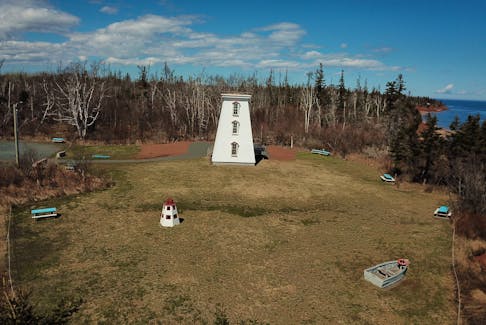
ERIN SULLEY: Never underestimate the power of a slow cooker in the kitchen – check it out by making this slow cooker apple pork
Updated 1 hour ago
|6 min read

One for the ages: Cape Breton comic proud to be a geriatric millennial
Updated 2 hours ago
|7 min read

Call to the hall: Cape Breton music industry recognizes 'undeniable' impact of Cameron, Fitzgerald, Foulds
Updated 2 hours ago
|4 min read
JOAN SULLIVAN: Crisp and evocative writing in Donna Morrissey’s seventh novel, 'Rage the Night'
Updated 2 hours ago
|5 min read
Cape Breton Community Calendar events for April 25-May 1
Updated 4 hours ago
|8 min read
Sports
More
P.E.I.'s Kensington Wild drops decision to Calgary at Telus Cup
Updated 12 minutes ago
|2 min read

MHL PLAYOFFS: Timberwolves tie series; Caps facing another suspension
Updated a day ago
|5 min read

NHL PUCK DROPS: Columnist offers playoff predictions
Updated a day ago
|3 min read
Atlantic All-Star event in Halifax will showcase the region's top female basketball players
Updated a day ago
|4 min read
P.E.I.'s Kensington Wild rally falls short in opening game at Telus Cup
Updated a day ago
|3 min read
Canada
More
Will province, HRM allow access to Dartmouth Cove infill site?
Updated 25 minutes ago
|5 min read

Pair arrested, cocaine seized in Corner Brook drug bust: RCMP
Updated 52 minutes ago
|2 min read

Pedestrian killed in collision with transport truck on TCH outside St. John's
Updated 1 hour ago
|1 min read
2024 looks to be record-high year for animal neglect and cruelty calls: New Brunswick SPCA
Updated 1 hour ago
|2 min read
First Quantum says probability of taking out copper from Panama mine only after election
Updated 1 hour ago
|1 min read
World
More
Huge energetic flare from magnetic neutron star detected
By Will Dunham WASHINGTON (Reuters) - Magnetars are among the universe's most extreme objects - a class of the compact stellar remnants called neutron stars that possess immensely strong magnetic fields. Once in a while, they produce enormous ...
Updated 36 minutes ago
|3 min read
Turkey accuses U.S. of double standards over Gaza in rights report
Updated 47 minutes ago
|2 min read

Mexico's presidential frontrunner Sheinbaum widens lead in April poll
Updated 57 minutes ago
|1 min read

India inspects spice makers MDH, Everest over alleged contamination
Updated 57 minutes ago
|1 min read
Biden notches another union endorsement as building trades back reelection
Updated 58 minutes ago
|2 min read
German spy agency warns companies against being too "naive" on China
Updated 1 hour ago
|2 min read
Recent Stories


New director appointed for N.S., N.B. Serious Incident Response Team
Updated 5 minutes ago
|1 min read
P.E.I.'s Kensington Wild drops decision to Calgary at Telus Cup
Updated 12 minutes ago
|2 min read
Goldman CEO's leadership criticized by ethics group at annual meeting
Updated 18 minutes ago
|1 min read
TikTok CEO expects to defeat US restrictions: 'We aren't going anywhere'
Updated 19 minutes ago
|1 min read