Top stories in Prince Edward Island
Fires in Kings County, P.E.I., believe caused by cigarette butts
Updated 1 hour ago
|3 min read

P.E.I. marks first cyberbullying day on April 25, 2024
Updated 2 hours ago
|3 min read
In state of the city address, Summerside mayor says community exploring 33-megawatt green hydrogen project
Updated 2 hours ago
|5 min read
UPDATE: MHL PLAYOFFS – Big saves, third-period goals send Miramichi to come-from-behind win over Caps
Updated 47 minutes ago
|8 min read
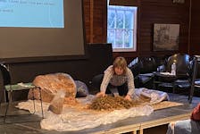
Build and grow a home mushroom farm with P.E.I expert Rene Lestan
Updated 4 hours ago
|5 min read
Local
More
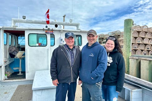
Lobster setting day in Northumberland Strait pushed to April 27
Updated 1 hour ago
|1 min read

P.E.I. marks first cyberbullying day on April 25, 2024
Updated 2 hours ago
|3 min read
In state of the city address, Summerside mayor says community exploring 33-megawatt green hydrogen project
Updated 2 hours ago
|5 min read
P.E.I. woman gets jail for break-in offences
Updated 4 hours ago
|3 min read
City of Summerside launches grant to help support vulnerable residents
Updated 5 hours ago
|2 min read
Opinion
More
LETTER: Carbon tax is simply another irrational decision by the current government to further burden all of us
Updated 52 minutes ago
|8 min read

LETTER: 'Tear down the wall' and let family members inherit fishing enterprises in N.L. without jumping through financial hoops
Updated 2 hours ago
|3 min read

BOB WAKEHAM: Battles between N.L. premiers and Ottawa nothing new
Updated 2 hours ago
|7 min read
MICHAEL de ADDER CARTOON: Alice in Trudeauland
Updated 20 hours ago
|1 min read
LETTERS: P.E.I. letter writers seek protection for people and the planet
Updated 21 hours ago
|2 min read
Business
More
Roll Up to Win confusion: Cape Bretoners disappointed after Tim Hortons email mistake
Updated 6 hours ago
|6 min read

Leon's furniture store completes relocation from Charlottetown to Summerside
Updated Apr. 23, 2024
|5 min read
CBRM seeks land-use bylaw change for supportive housing units
Updated a day ago
|5 min read
Hawaiian Electric weighing sale of American Savings Bank, Bloomberg News reports
Updated 4 minutes ago
|1 min read
Lifestyles
More
DOUG GALLANT: Hornsby, yMusic serve up unique fair
One of the most interesting collaborations to surface in recent memory brings together highly regarded singer-songwriter and keyboard player Bruce Hornsby and yMusic, the experimental New York chamber ensemble founded by trumpeter CJ Camerieri and ...
Updated 30 minutes ago
|3 min read
UPEI faculty of business receives $3 million donation from Don and Marion McDougall
Updated 4 hours ago
|2 min read

Build and grow a home mushroom farm with P.E.I expert Rene Lestan
Updated 4 hours ago
|5 min read
PAUL SMITH: What's the best bet for raincoats? Plenty of good options for outdoor enthusiasts in N.L.
Updated 5 hours ago
|9 min read
Value for money: Halifax resellers warn of the dark side of vintage shopping
Updated 19 hours ago
|7 min read
Daily horoscope for Apr. 25, 2024
Updated 15 hours ago
|2 min read
Sports
More
TELUS CUP: GM Duane Richards the heartbeat of P.E.I.'s Kensington Wild
Updated 22 hours ago
|7 min read

Pownal falls to Tri-County at Maritime junior C hockey championship
Updated 23 minutes ago
|1 min read

P.E.I.'s Kensington Wild plays second one-goal game at Telus Cup
Updated 4 hours ago
|2 min read
P.E.I.'s Kensington Vipers split games at Don Johnson Memorial Cup
Updated 1 hour ago
|2 min read
P.E.I.'s Kensington Vipers win opener at Don Johnson Memorial Cup in dramatic fashion
Updated 21 hours ago
|3 min read
Canada
More
Newfoundland woman banned from driving picks up new charges after speeding from Bonavista RCMP
Updated 1 hour ago
|2 min read

Spring weight restrictions lifted early on southern New Brunswick highways and roads
Updated 32 minutes ago
|1 min read

DFO opening mackerel bait fishery for Atlantic Canada and Quebec, but commercial fishery remains closed
Updated 1 hour ago
|3 min read
deCoste On The Road Tour hosting performers David Francey and Kellie Loder at the Legion
Updated 1 hour ago
|3 min read
Hearing from the electorate: Annapolis Royal, N.S., hosting meeting to discuss big projects
Updated 2 hours ago
|4 min read
World
More
New UK sanctions target Iranian drone industry
Updated 40 minutes ago
|1 min read

Russia says Polish discussion on hosting US nuclear weapons is dangerous
Updated 41 minutes ago
|2 min read

China summons German ambassador after spying arrests
Updated 1 hour ago
|1 min read
Putin urges restraint in state seizure of assets
Updated 1 hour ago
|2 min read
Yellen says range of options to deal with frozen Russian assets
Updated 1 hour ago
|1 min read
Recent Stories


Burkina Faso army executed over 220 villagers in February, HRW says
Updated 10 minutes ago
|3 min read
Doping-WADA to launch independent review into Chinese doping case
Updated 14 minutes ago
|3 min read
'It's a cool experience': Ethan Dickson proud to represent hometown of Kensington at Telus Cup national under-18 hockey championship
Updated 19 minutes ago
|4 min read
Pownal falls to Tri-County at Maritime junior C hockey championship
Updated 23 minutes ago
|1 min read